
Scarborough Southwest (Ontario)
Serving Scarborough Southwest (Ontario) with Better Solutions.
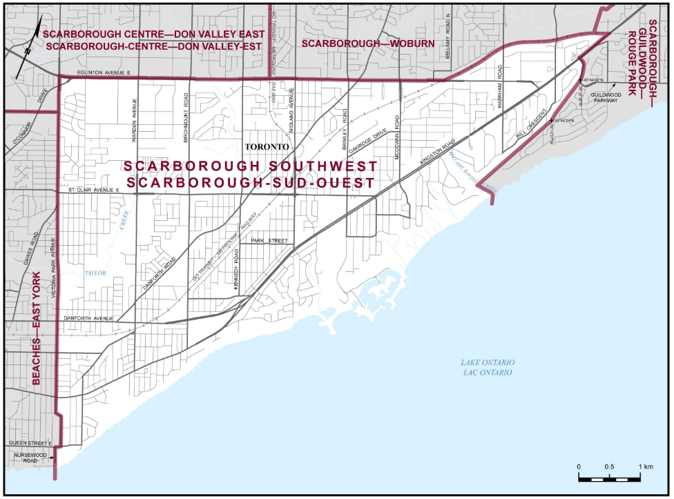
Boundaries description
Consists of:
Consists of that part of the City of Toronto described as follows:
commencing at the intersection of the GO Transit rail line and Kingston Road;
thence southwesterly along said road to Guildwood Parkway (Cromwell Road);
thence generally southerly along said parkway to a point at approximate latitude 43°44'49"N and longitude 79°12'16"W;
thence southerly in a straight line to a point at latitude 43°44'24"N and longitude 79°12'27"W;
thence southwesterly in a straight line to Bellamy Ravine Creek at approximate latitude 43°43'40"N and longitude 79°13'03"W;
thence easterly and southerly along said creek and its production to the southerly limit of said city (Lake Ontario);
thence southwesterly along said limit to the southerly production of Nursewood Road;
thence northerly along said production and Nursewood Road to Queen Street East;
thence easterly along said street to Victoria Park Avenue; thence generally northerly along said avenue to Eglinton Avenue East; thence easterly along said avenue to the GO Transit rail line (easterly of McCowan Road);
thence northeasterly along said rail line to the point of commencement.
Locations I'll Serve
Electoral district profile
Scarborough Southwest (Ontario)
Electoral district number:
35096
Region:
Ontario Region
Area:
30 km2
Population**:
123,232
Number of electors on list****:
85,571
Major census subdivisions (municipalities)***:
Toronto*
Adjacent electoral districts
Scarborough Centre--Don Valley East
Scarborough--Guildwood--Rouge Park
Scarborough--Woburn
Beaches--East York

davidvedova.ca Pages
CHP.ca Official Party Pages
FOLLOW CHP
Christian Heritage Party
Copyright 2026. CHP David Vedova. All Rights Reserved. - Website Designed by Kevin Schulthies of thetrumpet.app - Allowing those to Run, run with Excellence to win 1 Corinthians 9:24 - All inquires welcome